The Deed Chain of Title
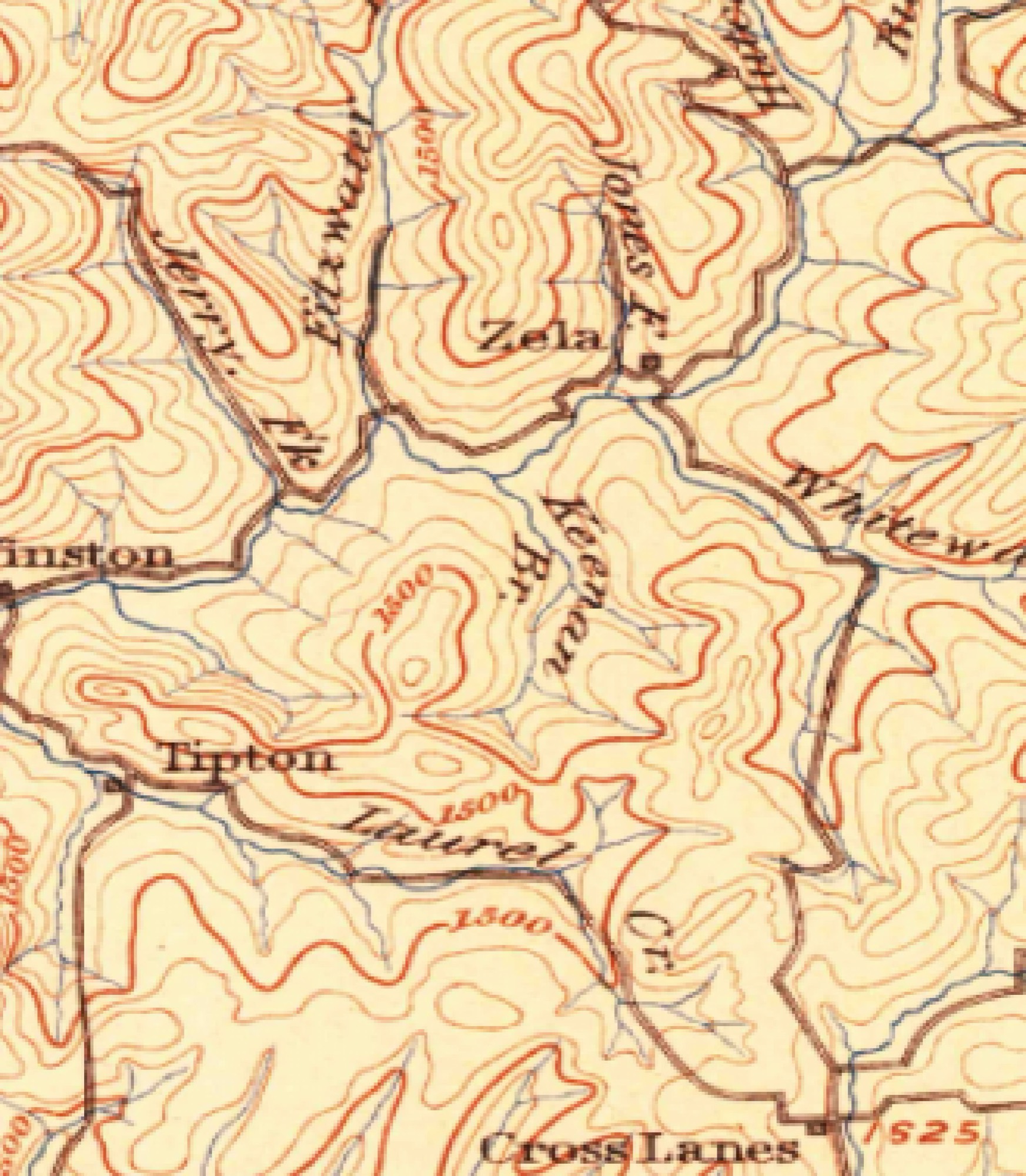
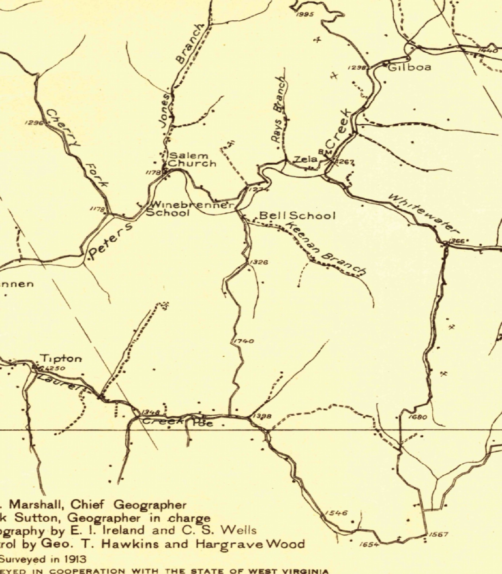
Source: Nicholas County Clerk online land-records index (Compiled Technologies "IDX Search"), http://nicholaswv.compiled-technologies.com/ — the public grantor/grantee index. Cross-referenced with WV statewide parcel/assessment data (WV_Parcels MapServer / ParcelSummary, services.wvgis.wvu.edu).
What "Keenan" refers to. Three unrelated things share the name, and they are easy to confuse. Keenan Branch is a stream — a real named tributary (U.S. Geographic Names feature 1541098) the farm lies along; both parcels are described "SUR LAUREL & KEENAN" and "SUR KEENAN BR," meaning they sit on Laurel Creek and Keenan Branch. The branch carries the surname of an early Nicholas County Keenan family — a name woven through the county's founding-era history, and still riding an on-farm gas well ("George Keenan #1"), an old "W.W. Keenan Tract," and the 1873 deed at the foot of this chain; it was already lettered "Keenan Br." on the 1889 U.S. Geological Survey map shown above, roughly 120 years before the coal company existed. Keenan Minerals, LLC is a wholly separate, modern coal company (part of the JSW Steel USA group) that leased the severed deep coal and applied for a surface mine here that was never built — it is not the Dalporto family and owns none of the surface; it simply reused the branch's name for its mine permit. The Dalportos own the surface, the shallow (above-drainage) coal, and the oil & gas; only the deep coal is severed away.
Target parcels (owner: DALPORTO JEANNEAN, Trustee of the Jeannean C. Dalporto Inter Vivos Trust)
- 34-02-0016-0027-0000 — 469.224 ac deeded (GIS-calc 431.10 ac) "SUR LAUREL & KEENAN /2B/", Grant District; current deed Book 544 / Page 649; Tax Class 3; LandUse 112 Active Farm; Land appraisal $80,500 / Total $169,100; physical "OFF RT 129".
- 34-02-0016-0015-0001 — 3.520 ac deeded (GIS-calc 5.42 ac) "SUR KEENAN BR", Grant District; current deed Book 544 / Page 653; Tax Class 2 (Residential); physical "KEENAN BR".
Chain of title
Most recent first — each link is a recorded instrument in the Nicholas County land books.
- 2022Corrective deed into the Trust (Bk 544/649): Jeannean C. Dalporto → the Jeannean C. Dalporto Inter Vivos Trust — "486 acres, Grant District," with companion deeds 544/645 and 544/653.
- 2021Into the Inter Vivos Trust (Bk 544/231–245): the 467.78-acre surface, the 3.52-acre tract, and "486 acres & minerals" conveyed to the new Trust; the Trust Agreement is recorded at 544/245.
- 2018Estate of John S. Dalporto (d. 2017; Bk 511/9–29): his heirs deed their shares to Jeannean C. Dalporto — e.g. "½ interest, 467.78 COG&M, Laurel Creek & Keenan Branch."
- 2004Oil & gas consolidated (Bk 423/276): Norma Lucille Nutter Dalporto → John S. Dalporto — "undivided ⅔ interest, oil & gas, 486 A + 97 A."
- 1992The shallow coal comes back (quitclaim, Bk 348/118): Terry Eagle Coal Co. → John S. Dalporto — the above-drainage coal seams (467.78 A) released to the surface owner, while the deep coal stays severed.
- 1978Declaration of Unitization (Bk 48/105): Duke Coal Company pools the ground — most consistent with the 1975–79 shallow-gas drilling campaign.
- 1973The Dalportos buy the farm (Bk 251/359): Duke Coal Co. → John, Norma & Secondo Dalporto — "565.42 A, part fee & mineral." The family's original acquisition.
- 1970Assembled by Duke Coal (Bk 235/356): Ben P. Brown, Trustee → Duke Coal Co. — "565.42 A, part fee & part mineral."
- 1873The oldest local deed (Nicholas Co. Deed Book 13): the Keenan / Koontz family — the deepest link the free county index reaches; its recited surveys run back to John Hamilton's grant and the Grose surveys.
Notes
- "COG&M" / "pt fee & mineral" = the surface + above-drainage coal/oil/gas/minerals the Dalportos hold; the deep/below-drainage coal was severed ("SUR") and runs on the separate Keenan/Dixie coal chain (Clearfield Bituminous -> Seelinger & Kamm -> Terry Eagle Coal -> Apache -> F&N -> Keenan Minerals).
- The 1992 Terry Eagle Coal Co quitclaim (348/118) returned the ABOVE-drainage coal seams (467.78 A) to John S. Dalporto, i.e. Terry Eagle (a link in that coal chain) released the shallow seams back to the surface owner while retaining the deep coal.
- Acreage aliases for the same core farm: 565.42 (1970/1973 parent), 467.78 (coal), 469.224 (surface, current assessor), 486 (consolidated mineral/current deed legal), plus a separate 97 A tract.
- "John S. Dalporto" = "John Secondo Dalporto" (1947-2017); estate administered in Kanawha County (fiduciary order Bk 41/396; settlement Bk 48/412, 2018).
A note on the records
The facts of this chain — the dates, book-and-page numbers, parties, and legal descriptions — are public and confirmable through the Nicholas County Clerk's free online land index. The scanned deed pages themselves are not freely publishable: viewing a document image requires a county-clerk subscriber account (or a signed-in FamilySearch session), so this page reproduces the verified index record rather than the deed scans. The oldest links in the chain — the original Virginia land patents — are freely viewable, and one is reproduced on the Land Grants page.